MILWAUKEE INDUSTRIAL LAND ANALYSIS

A plan to protect Milwaukee's critical industrial land
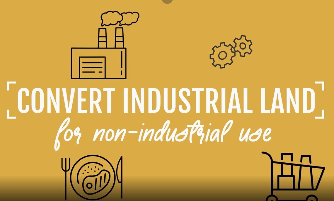
Providing effective strategies to protect critical industrial properties from redevelopment for non-industrial uses, support the growth of the industrial sector and employment centers, and attract and retain industrial development to the City of Milwaukee.
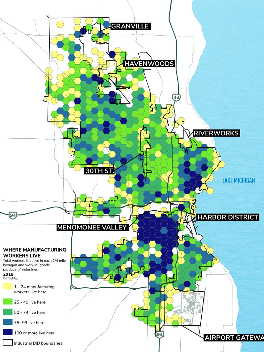
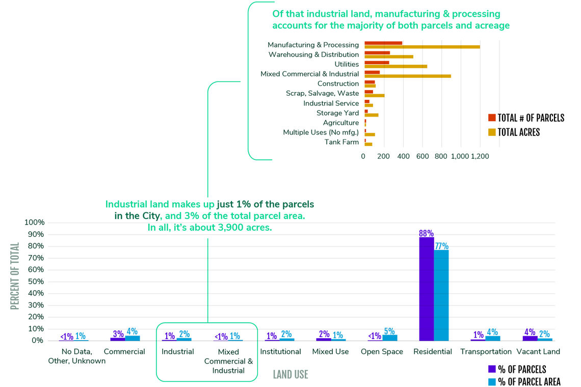
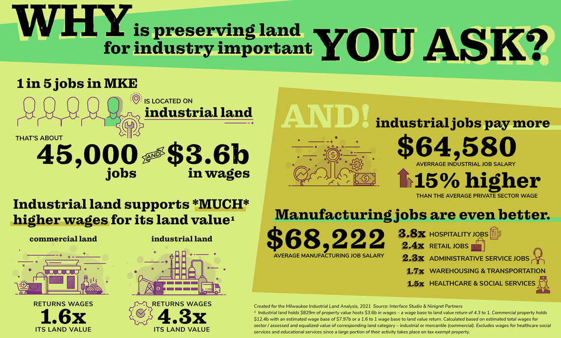
Milwaukee has a long, proud history as a manufacturing powerhouse. This industrial legacy remains critical to Milwaukee’s economy today. Approximately one in five jobs in Milwaukee reside on the city’s industrial lands, and one in ten jobs in Milwaukee is a manufacturing-related job. The land use and facilities needs of modern manufacturers continue to evolve and the City of Milwaukee is ensuring that its industrial zoning and land use policies facilitate continued reinvestment and job creation.
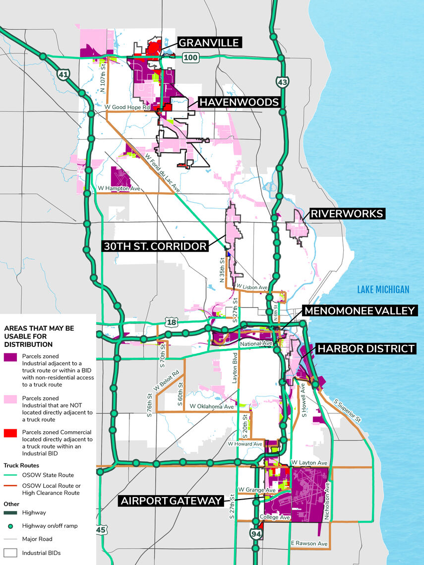
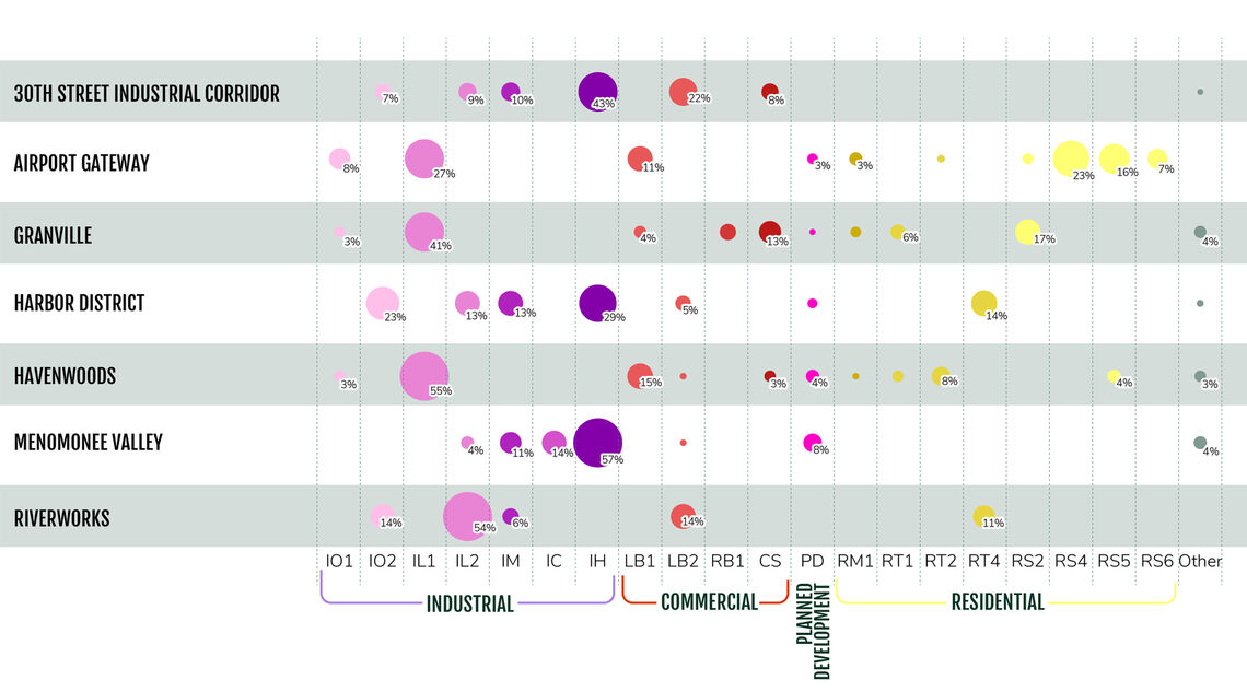
Interface Studio undertook a comprehensive update of the City’s industrial properties by land use and zoning to ensure that zoning regulations and industrial land policies and strategies align with current trends and market forces impacting industrial development. This work was tied to a market study to help place Milwaukee’s industrial opportunities in the context of regional and national trends.
Milwaukee has a long, proud history as a manufacturing powerhouse.
Approximately one in five jobs in Milwaukee reside on the city’s industrial lands, and one in ten jobs in Milwaukee is a manufacturing-related job.


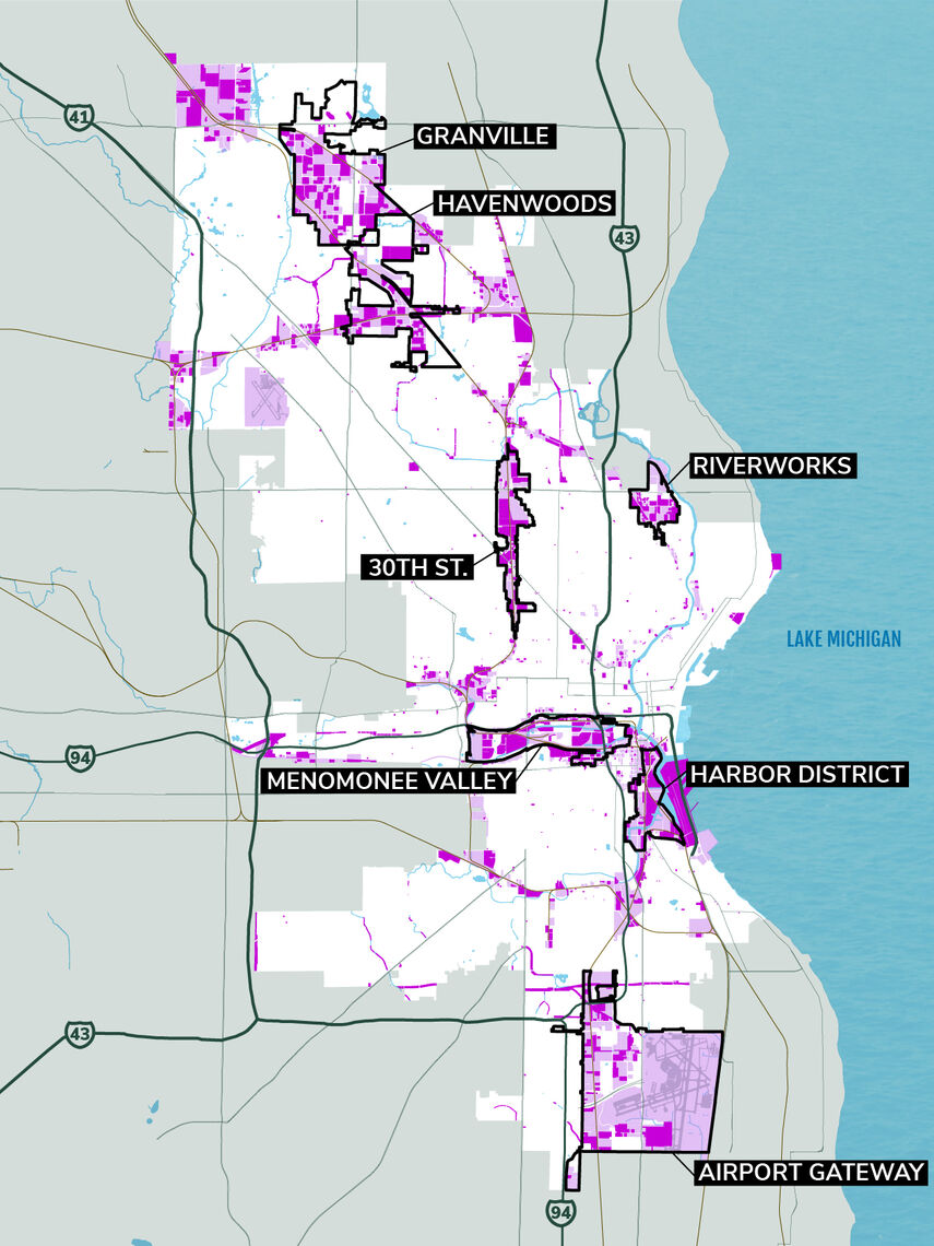
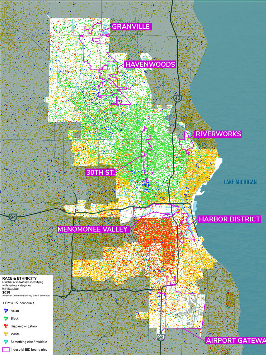
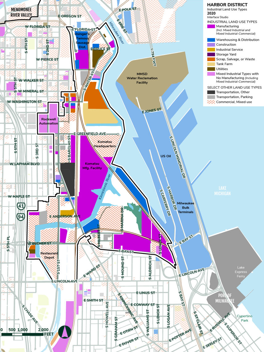
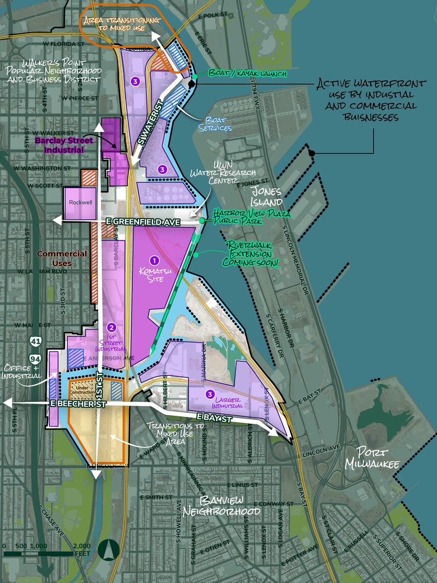
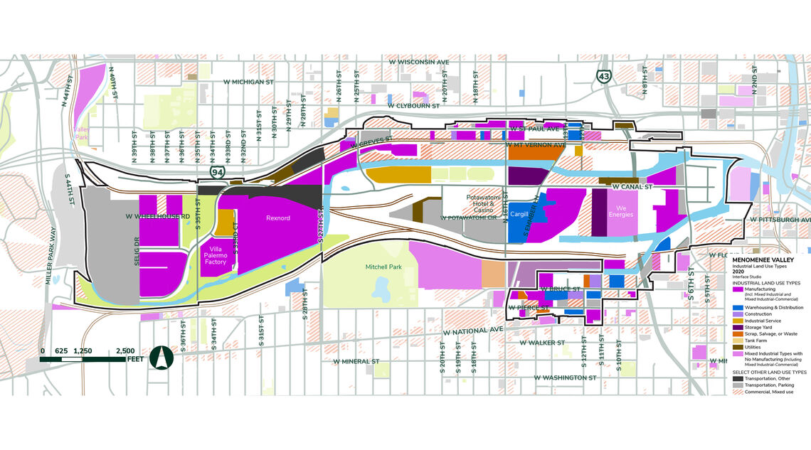
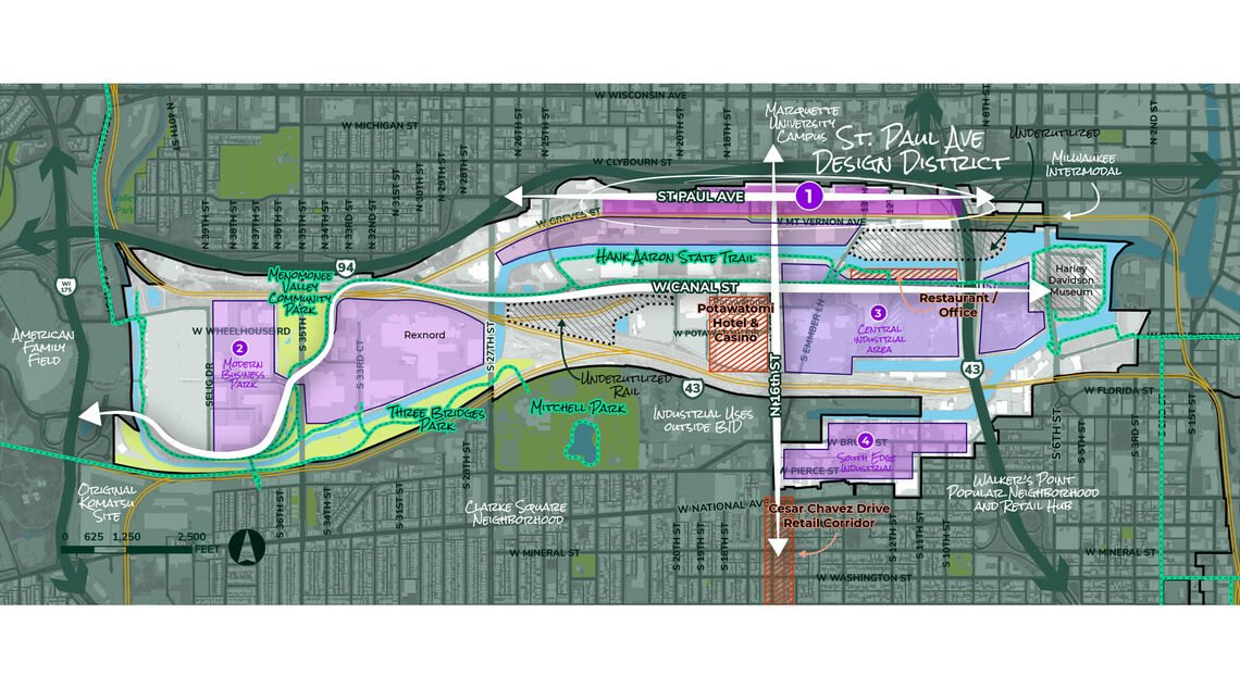
Working with local partners, the team created an accessible website for the project and an informational video and infographic about the importance of the City’s industrial businesses and land. Our engagement efforts focused on land and businesses owners, developers, and BIPOC industrial business stakeholders. Milwaukee’s 7 Industrial BIDs were integral partners. Our work helped each of the BIDs refine their own strategies as well as provide overarching guidance that can be used across the City of Milwaukee to support modern industry through the zoning code and other land use policies.
The Industrial Land Analysis document was approved by Common Council on September 21, 2021. Results of this analysis will influence land use and zoning decisions for years to come.